
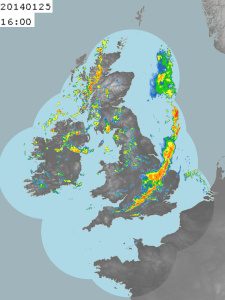
Providing the best possible spatial representation of rainfall is vital to support hydrological applications, whether for urban drainage management or flood forecasting. This principle applies at various spatial and temporal scales for rainfall estimates in both gridded and catchment-average form.
With a UK-focus, the Committee are hosting a workshop that intends to bring together those in the user community and lead scientists with an interest in utilising best possible estimates of rainfall through merging approaches. The workshop will provide a forum for sharing techniques in merging whilst recognising differing requirements in urban/rural and pluvial/fluvial environments. It will consider data sharing and assimilation and what are the restrictions on UK-wide collaboration in real-time approaches to merging. Output from the workshop will include a gap analysis of user requirement and opportunities for further collaborative work. Science presentations will be provided by the Met Office, Environment Agency, Hydro-Logic, CEH Wallingford and Imperial College (RainGain).
The workshop is set to take place on the 29th May 2014 at the Medical Research Council in London.